Lifelines
Berat, Albania
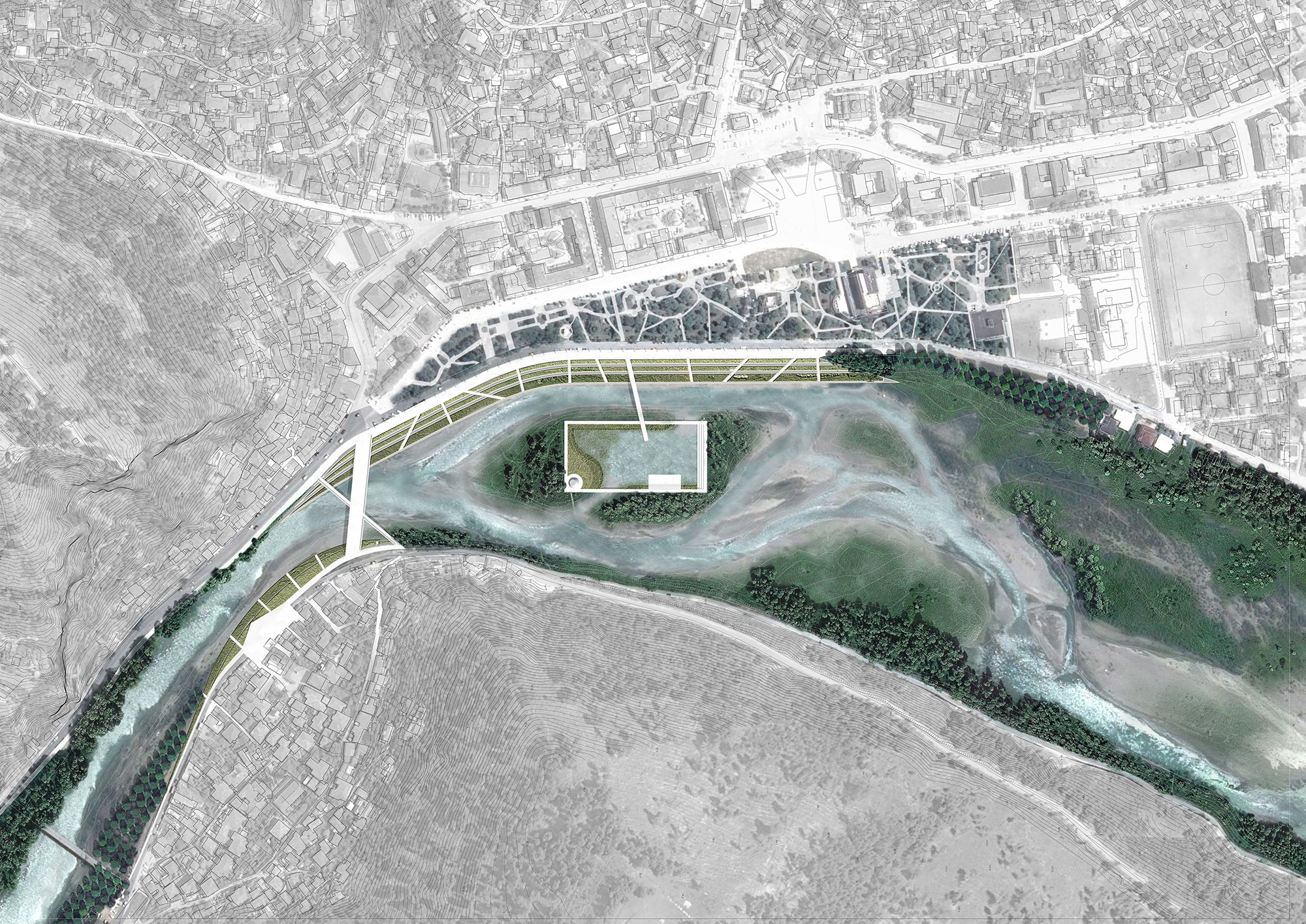
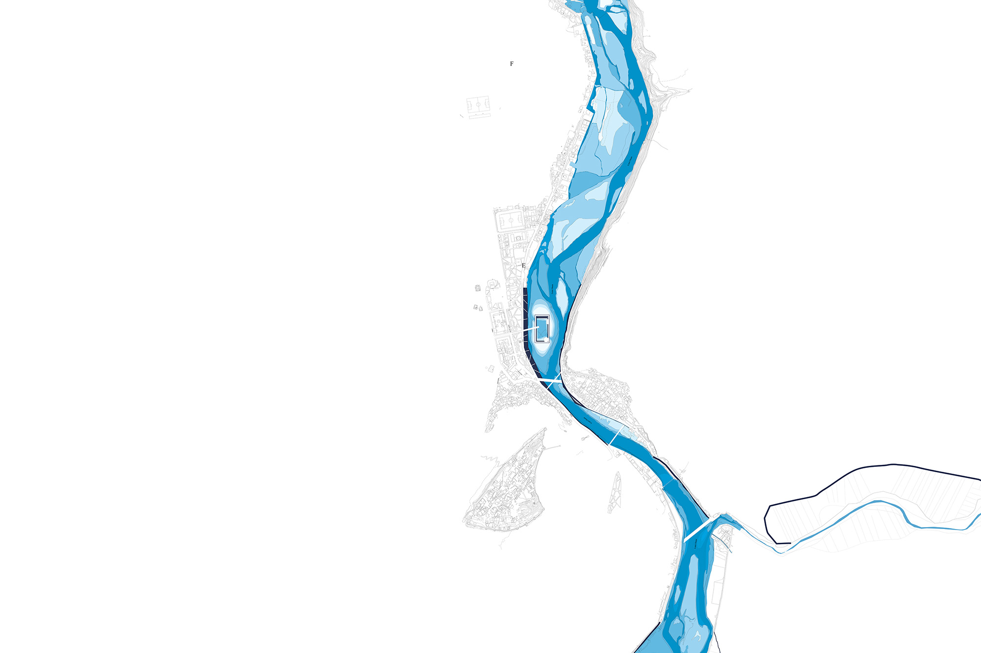
Approaching an island doesn’t mean to approach a defined fragment of territory. An island is part of the larger organism of the river, and is the river the natural element under our spotlight. The dependence of the Osumi Island to its river is so evident that is not even possible to define the shape of the island, continuously transforming with the varying water levels to the extreme of disappearing. In our proposal we consequentially start by addressing a more resilient water system that can absorb risks and vulnerabilities and develop its own cultural and recreational identity. Osumi Island is part of it; its context makes the island unique. The Unesco heritage site and the urban context integrates with the natural system of the river generating a all new range of possible scenarios and a new cultural gravity which is urban, by nature.
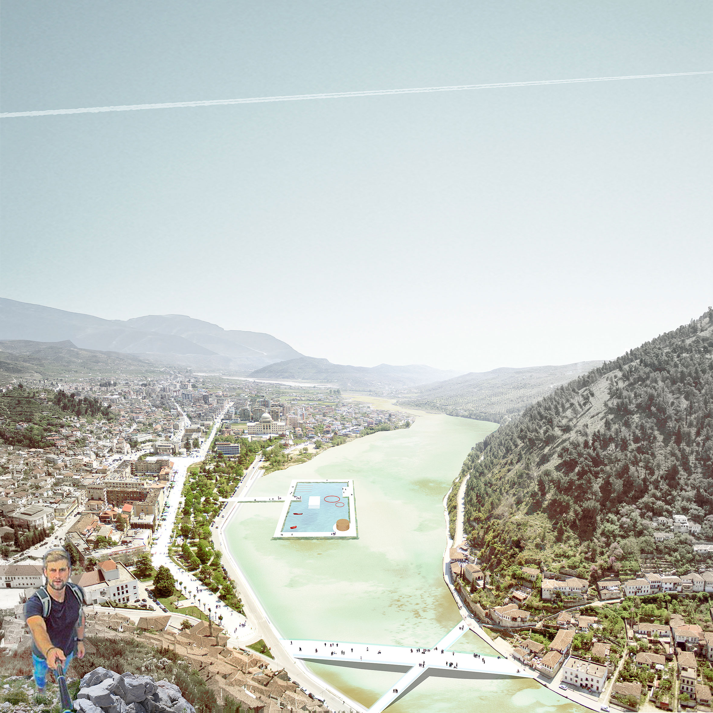
Our proposal aims to reconnect cities (in our case Berat) to the river, connection that has faded in many situations, if not even lost. Establish an interdependence is the trigger for addressing urbanites to sustainably take advantage of the water resource rather than a careless exploitation.
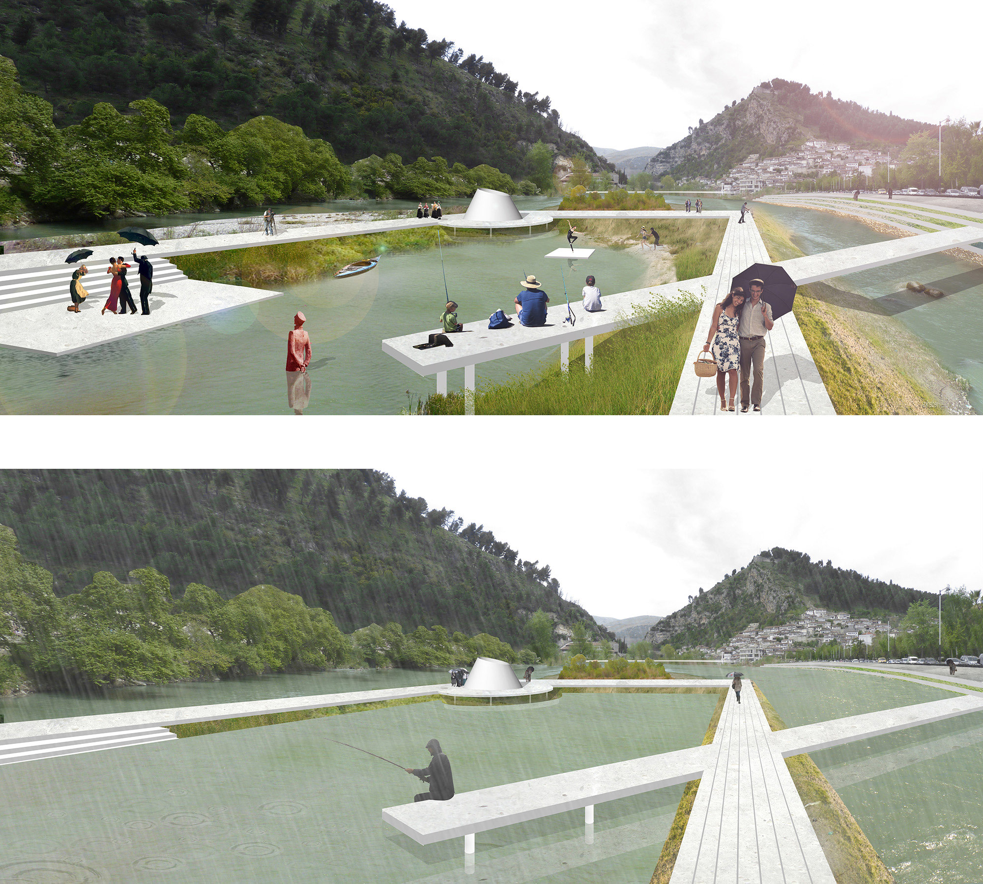
The project redefines the public space of the city of Berat, introducing more space for temporary and fixed uses, related to different programs. Following the logic inTroduced by the project the new bridge, the “frame” and the path connecting Bulvardi Repulika are considered “fixed /established” spaces that offer ground to “temporary / mobile” events.
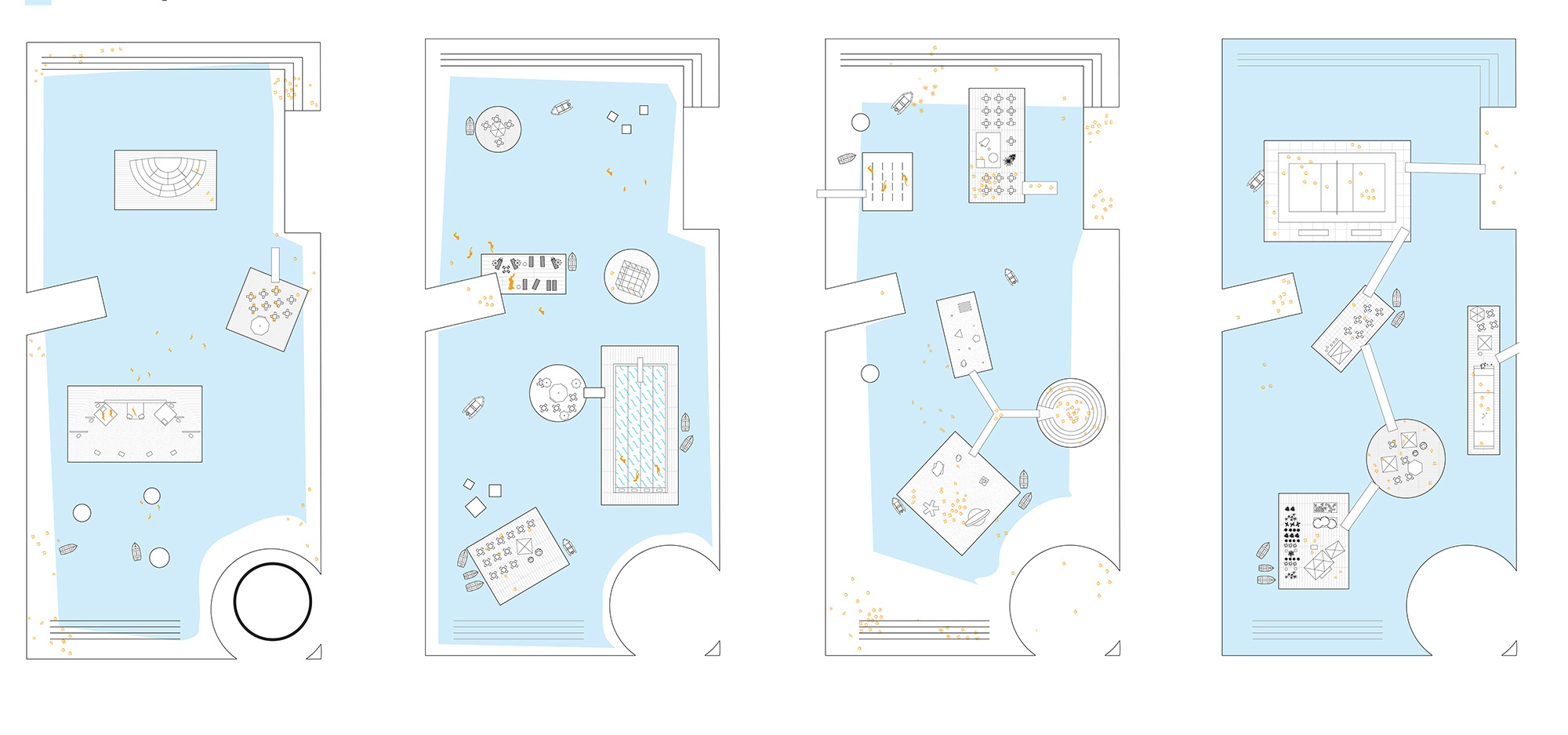
The Island adapts itself to the different levels of the water generating an always-changing landscape around and in the pool. While the pool itself gives extra volume for the water to reduce flooding risk, it creates the conditions for a variety of new recreational scenarios.
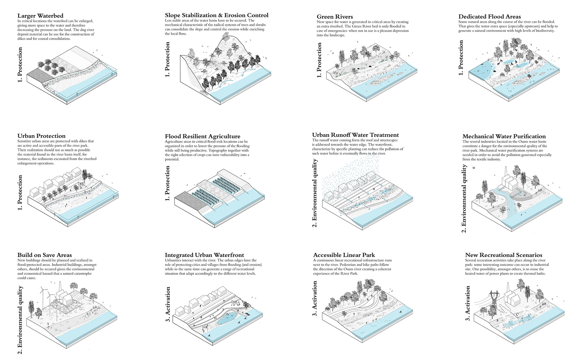
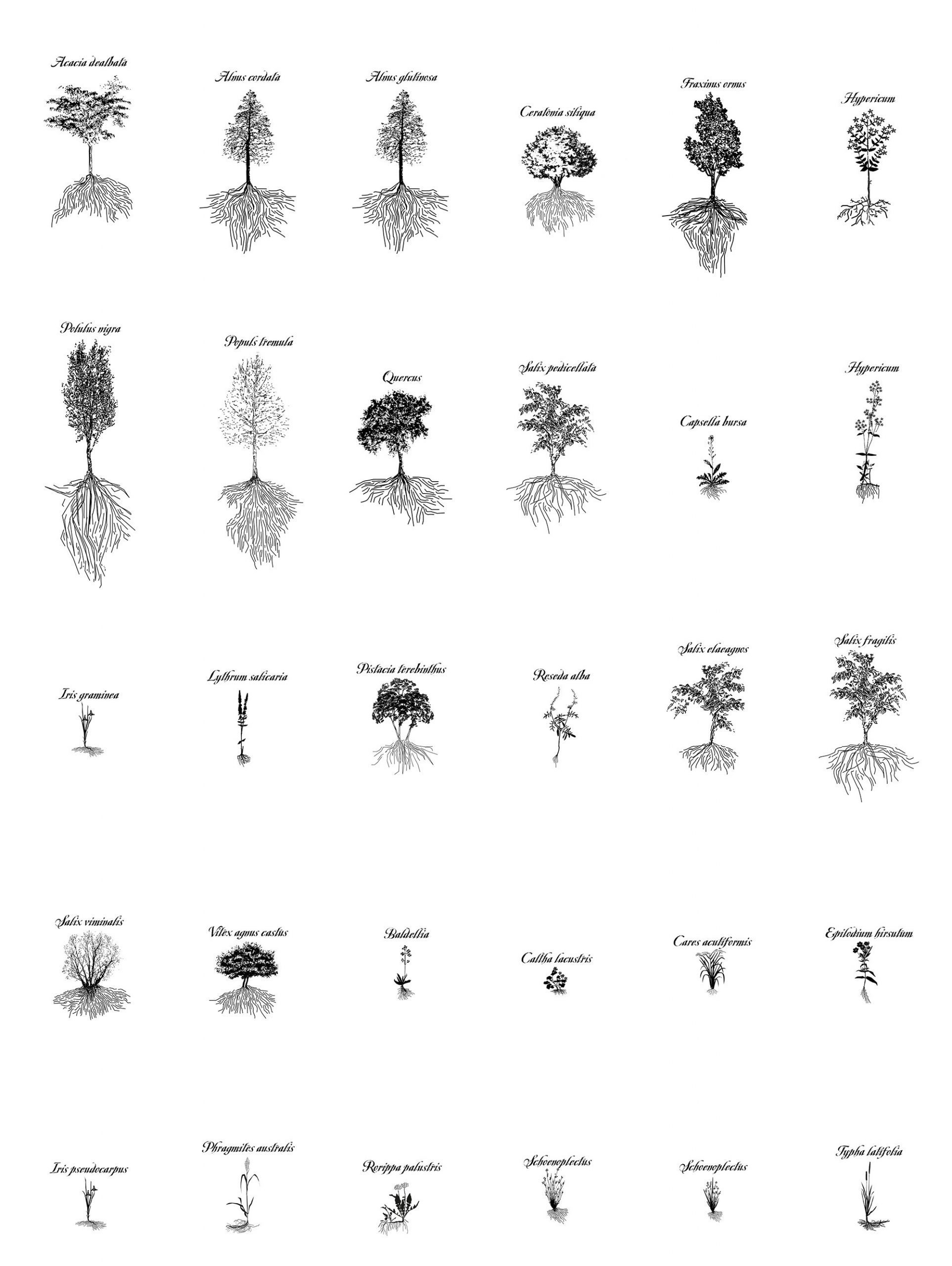
The planting species are selected on the basis of different aspects. First of all species are all indigenous and part of the local riparian landscape. They are divided is three categories: (1) plants and trees above the water level, (2) plants on wet soil, temporary flooded, (3) plants constantly on wet soil, often flooded. The species selection is driven by their biological and aesthetic characteristic as capacity to: increase the water quality, consolidate the slopes and decrease the erosion, capability of attracting wildlife, blossoming quality.
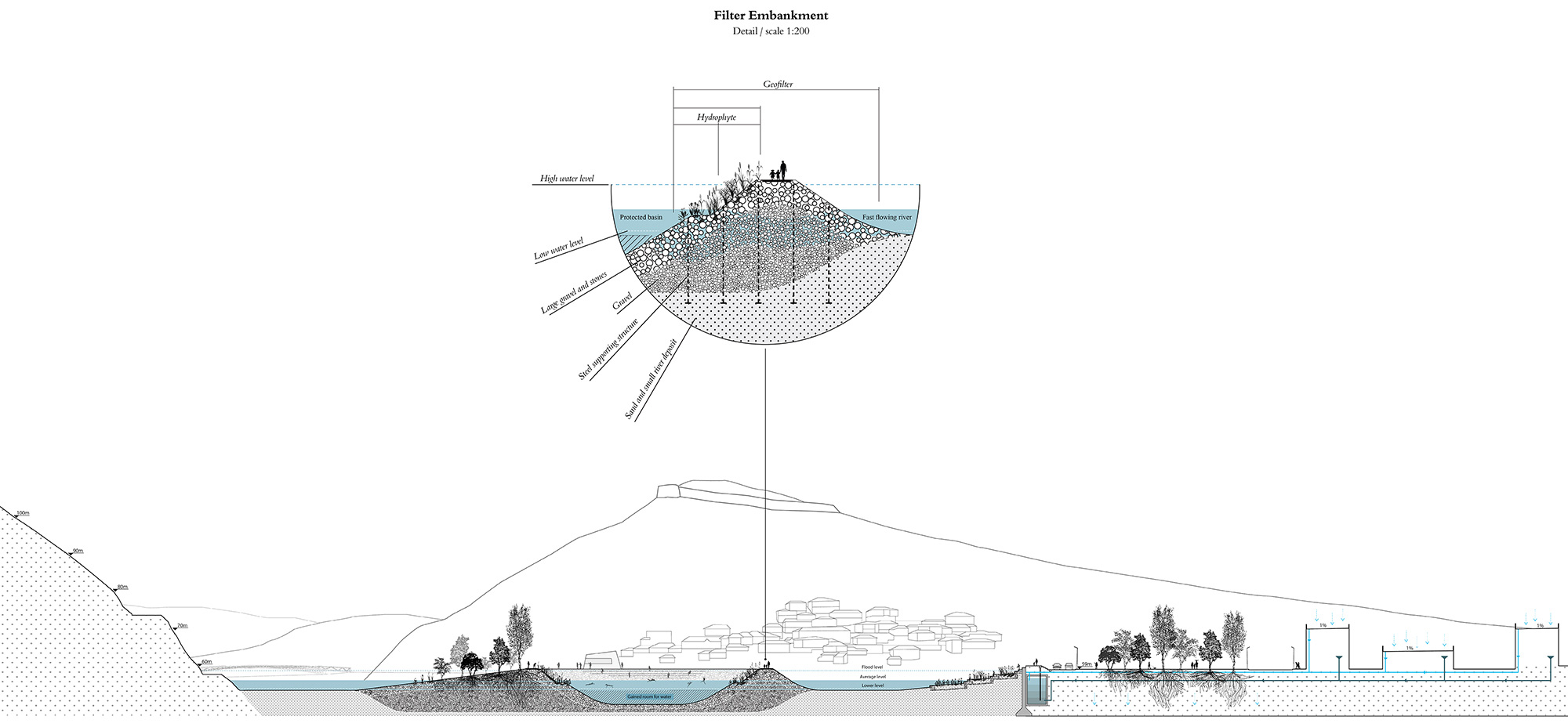
The ‘filter embankment’ is the element that defines the new island. It consists of a layered structure of gravel and stones of different grain sizes. It works as a horizontal filter: the water of the river infiltrates into the embankment before gathering into the water basin. In the inner part, selected vegetation works as a second phytoremediation filter, oxygenating the water and reducing pollutants. The whole system is supported by a steel structure and has a path running on the top.
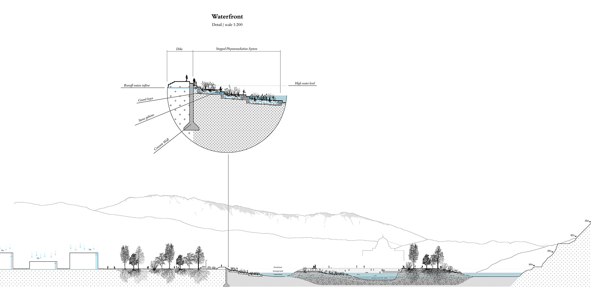
The waterfront is a performative urban edge. The runoff water is addressed to the edge, where stepped phytoremediation planting purifies the water before it flows into the river. The sidewalk is enlarged in order to improve the pedestrian experience, and the waterfront is accessible allowing people to finally ‘touch’ the water. An urban dike is added by raising the sidewalk to avoid flooding where the current water edge is too low.