Da-Ring
Rotterdam, Netherlands
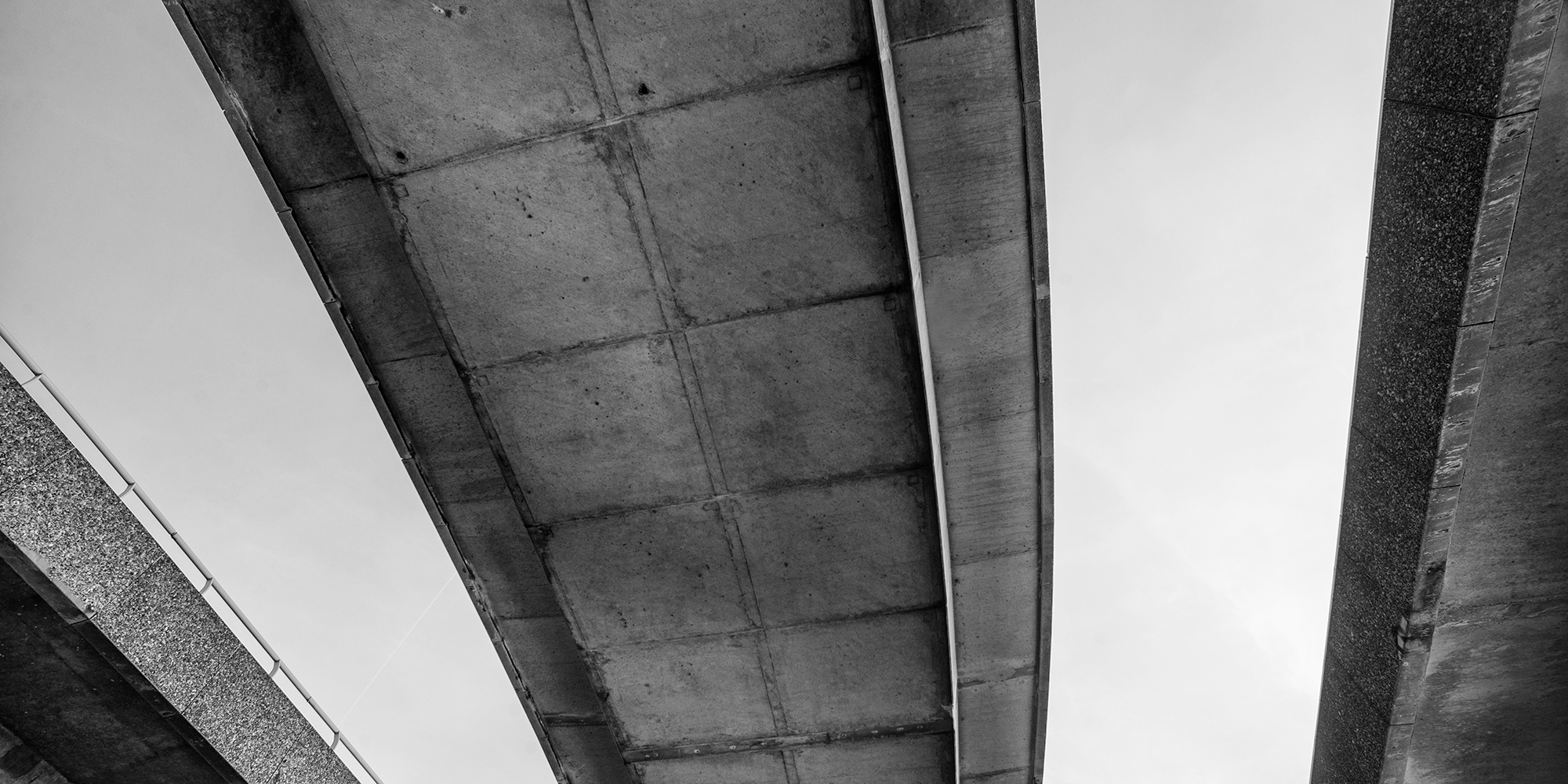
Ring roads are motorway systems build around a town or a city. Such infrastructures are often barriers that separate the city into an internal and external part; they reduce physical connectivity between parts and they disconnect functions. The areas next to these infrastructures have a very specific programmatic typology. With time they have attracted program that was not disadvantaged by the disturbed conditions that the highway creates (noise, pollution, disconnection…) such as industrial areas and warehouses.
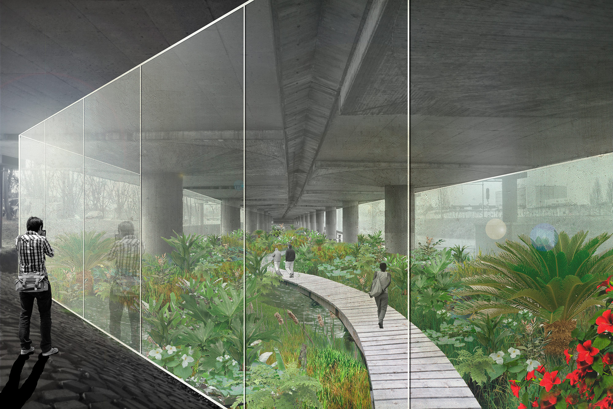
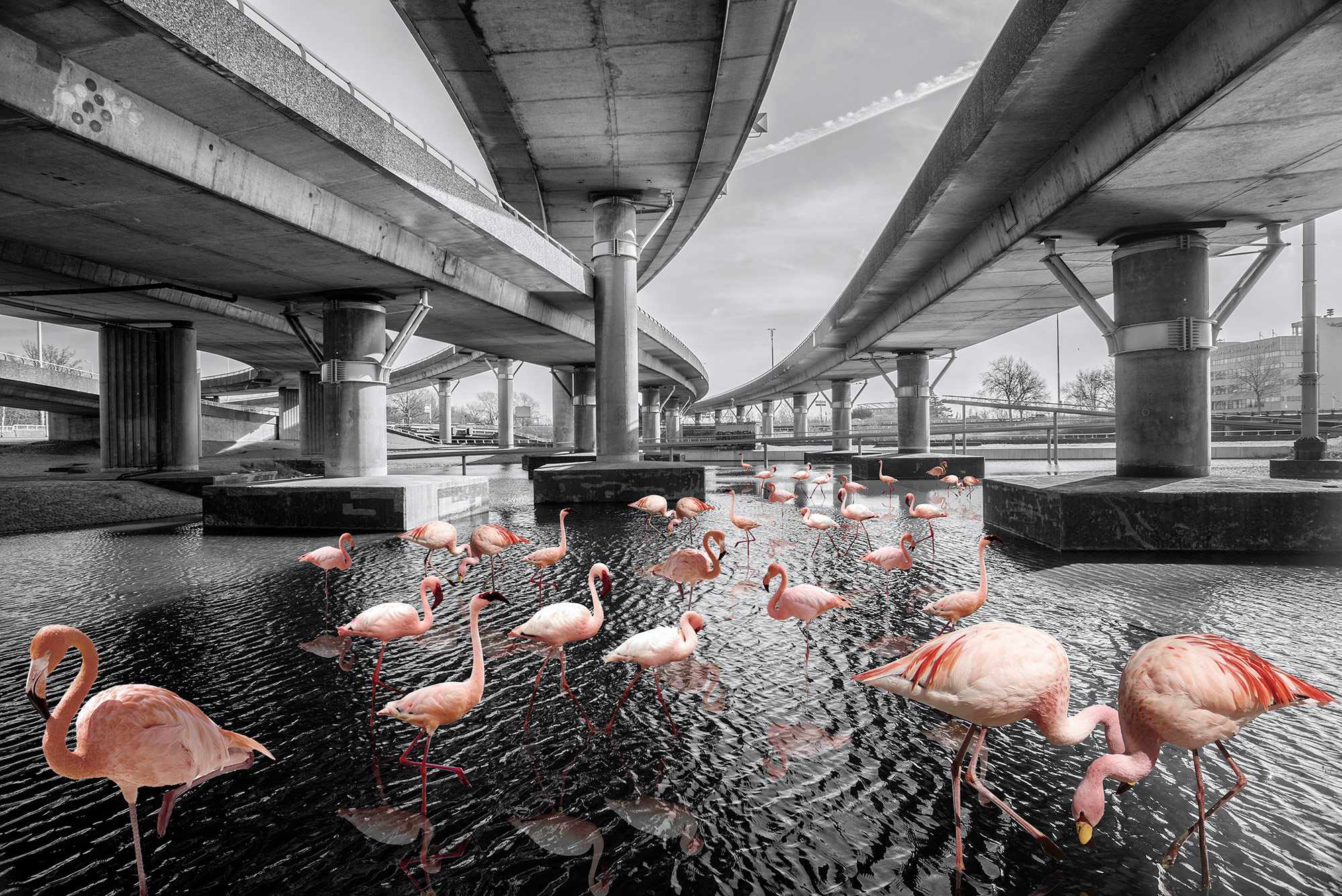
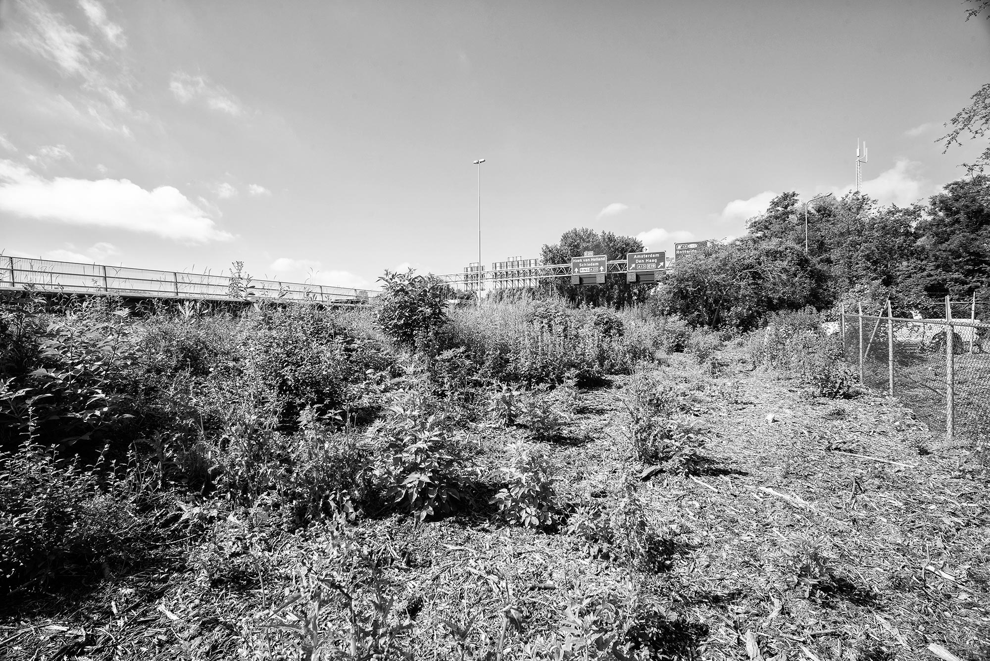
On the other hand, these areas have also been occupied by large scale open and recreational spaces such has parks, allotments gardens, golf courses, and Zoos. But, even more interesting, ring roads have created ‘no man’s land’, unused leftover spaces where it is not possible to build (yet) and that haven’t been dedicated to specific functions. No use, and no identity.
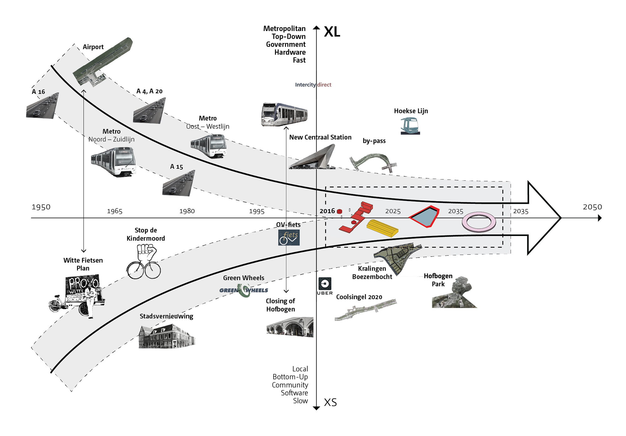
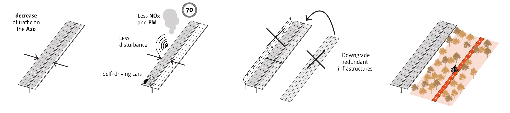
But, if we look at the trends in mobility, we know traffic conditions will improve: smart mobility technologies and sharing systems might reduce the number of cars and the needed space for traffic. Furthermore, the diffusion of the electric cars will reduce noise and cut environmental pollution. Assuming such trends won’t be disregarded and the environmental conditions of these areas, next to and within highways, will dramatically improve in the coming 1 or 2 decades, what is the future of motorway landscapes in cities? What is the future of ring roads landscapes? What is the future of the A20 and the Northern part of Rotterdam?
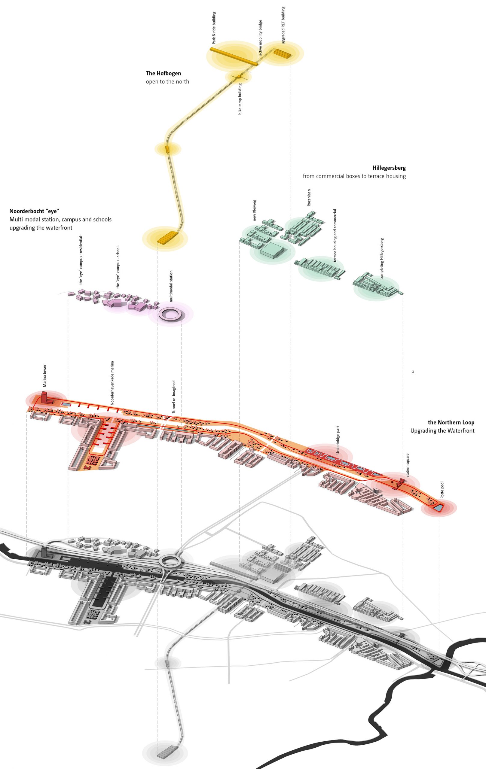
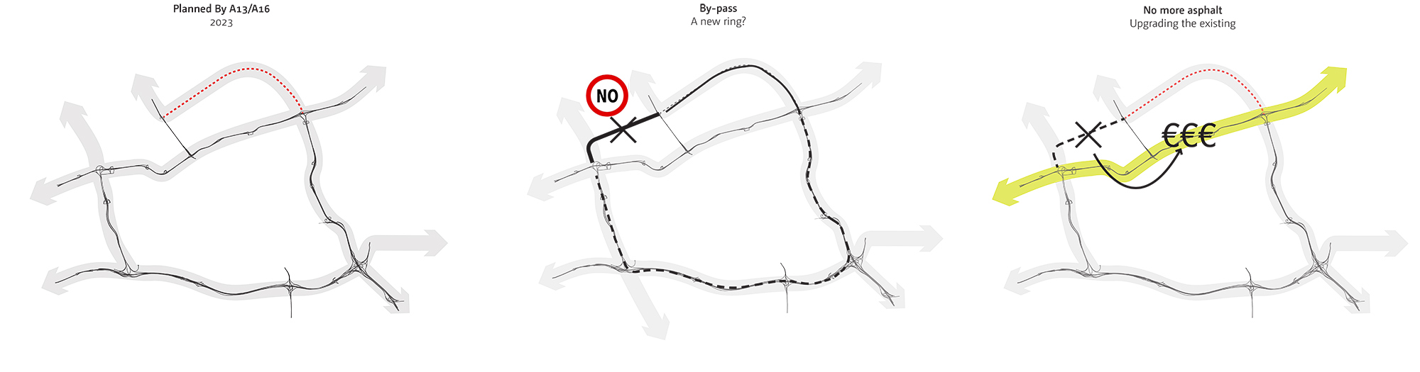
Rotterdam will build a new by-pass by 2023 that will reduce the traffic on the northern part of the ring road. We strongly suggest refraining from the temptation of closing the loop and forming a new ring. We disagree with the trend of expanding infrastructures more than needed, which often results in pushing the problem outwards to the next periphery. By reducing investments in new infrastructure, the city can upgrade the existing infrastructure and improve the conditions of the areas adjacent to the ring road.
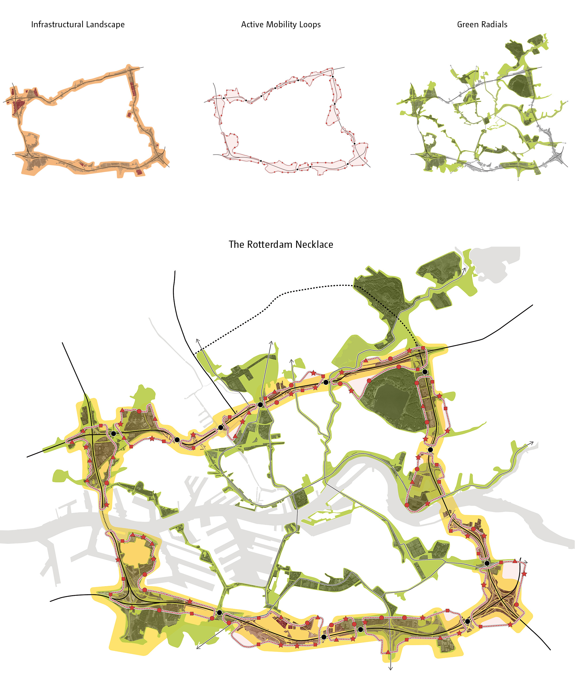
On their own, the left over areas and large recreational spaces next to the ring road are valuable landscapes. By creating a system enabling accessibility based on active mobility, these landscapes can finally become usable by citizens. Overlapping these landscapes with the existing urban green network generates the ‘Rotterdam Necklace’, a system of public and accessible open spaces centered around the principle of reclaiming left-over spaces for urban communities.
The forthcoming by-pass will lead to a decrease of traffic on the A20, and, with time, smart mobility technologies will reduce the space needed by vehicles, decreasing the environmental disturbance of the motorway. The new condition will bring about possibilities for the reuse and reprogramming of infrastructures which will have become redundant. We propose repurposing the highway as an urban road, potentially reducing the amount of the ring road needed to be removed completely. This would allow for the road at city level to be transformed into a park.
Looking back, in the city recent history it is evident that top-down processes associated with large infrastructure were detached from small scale community-lead initiatives. With our proposal we address the need to connect the large scale with the small scale – government decisions with local community needs. Re-thinking infrastructural spaces can increase quality and generate opportunities for the inhabitants, while providing a larger urban and regional service.