Marconiplein
Rotterdam, Netherlands

Traditionally, transport and public spaces are seen as conflicting systems, notion that has led to strategies oriented in separating mobility flows.
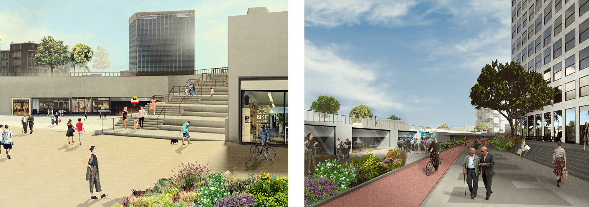
But conditions are changing. The enhancement of slow mobility, the reduction of vehicular traffic, the technological improvements are leading to a sharp decrease of disturbance from transport sources. New scenarios are possible where vehicular transport and pedestrian areas can be integrated in new qualitative hybrid public spaces.
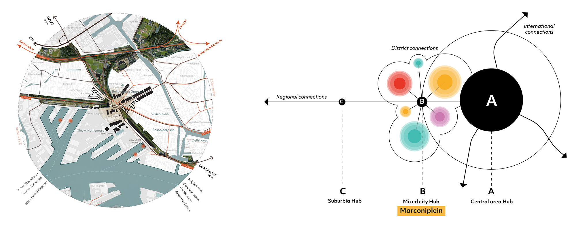
Marconiplein is a Mixed-city hub typology: it is not located in the city center nor in the suburbs and can function as connection between the two. Such specific condition can play the role of connecting the adjacent districts together reinforcing the relevance of Marconiplein as a pivotal point, a new center, of the west.

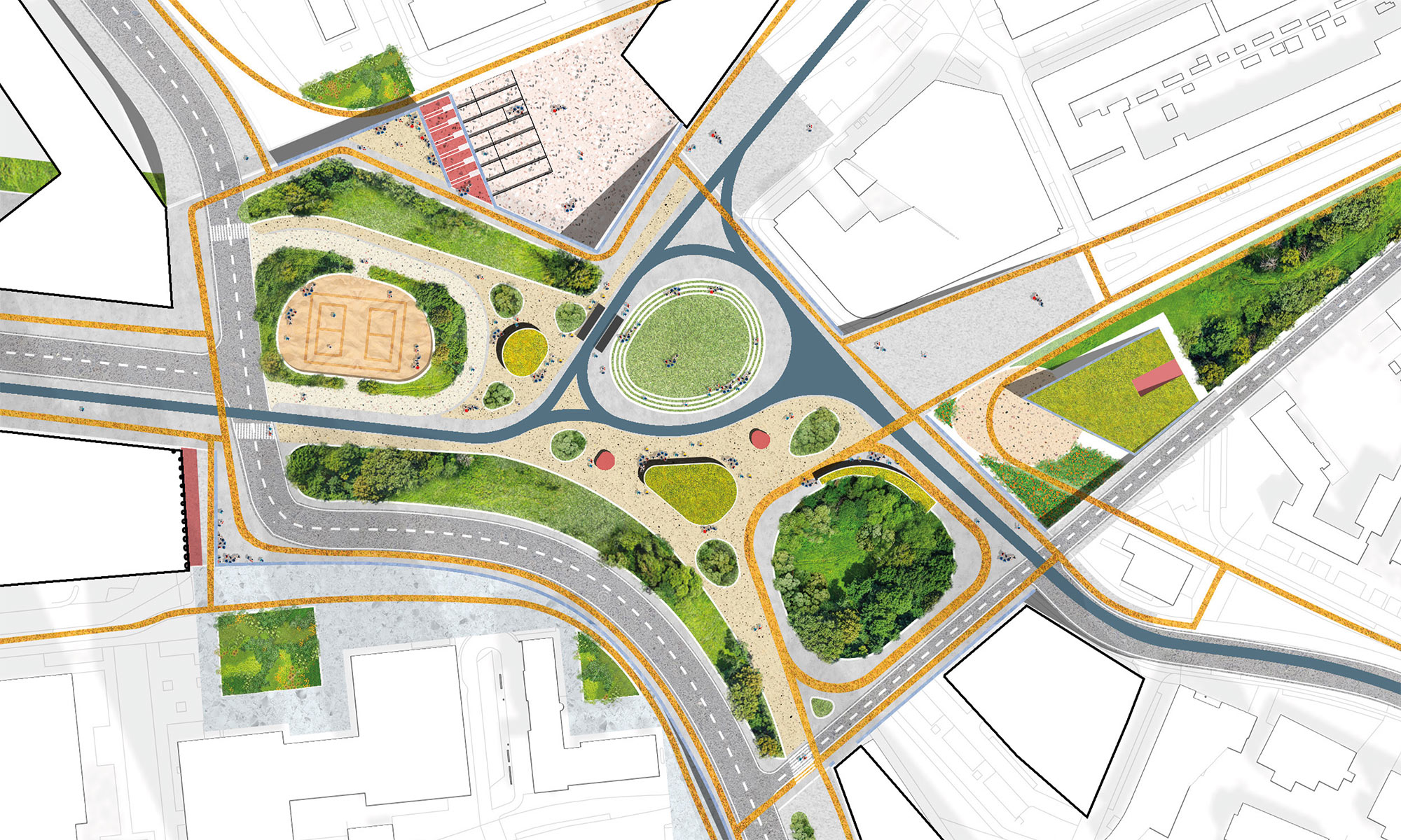
Currently Marconiplein is a large void in contrast with the adjacent districts charachertized by strong identities. The square is a transport-dominated space, defined by large number of mobility infrastructures, intersecting at different levels.
Above all, Marconiplein is a dike, defending the city -below sea level- from the river fluctuations. Yet, the changing climate, poses a new challenge, as models indicate that the dike height may result insufficient, in the coming decades.

The proposed vision aims to capitalise the strong and dynamic identities concentrated in the west of Rotterdam, changing the paradigm of Marconplein as a barrier. The need of re-thinbking the dike, is reflected in a new complex infrastructure, where the different neighbourhoods interface with the square in multiple ways. The hidden tridimensional nature of the square is unveiled and transformed into an articulated system of public spaces.